
This Itinerary uses Santa Cristina Gherdëina as its base, a beautiful, less crowded Alpine Town in the Val Gardena area.
Using Santa Cristina Gherdëina as a single base allows you to explore the Dolomites efficiently while avoiding constantly packing and unpacking. Located in Val Gardena, this quiet alpine village offers easy access to iconic hikes, scenic mountain passes, and charming towns, all while enjoying alpine life in a less touristy town. This Itinerary would also work if staying in nearby Ortisei or Selva di Val Gardena.
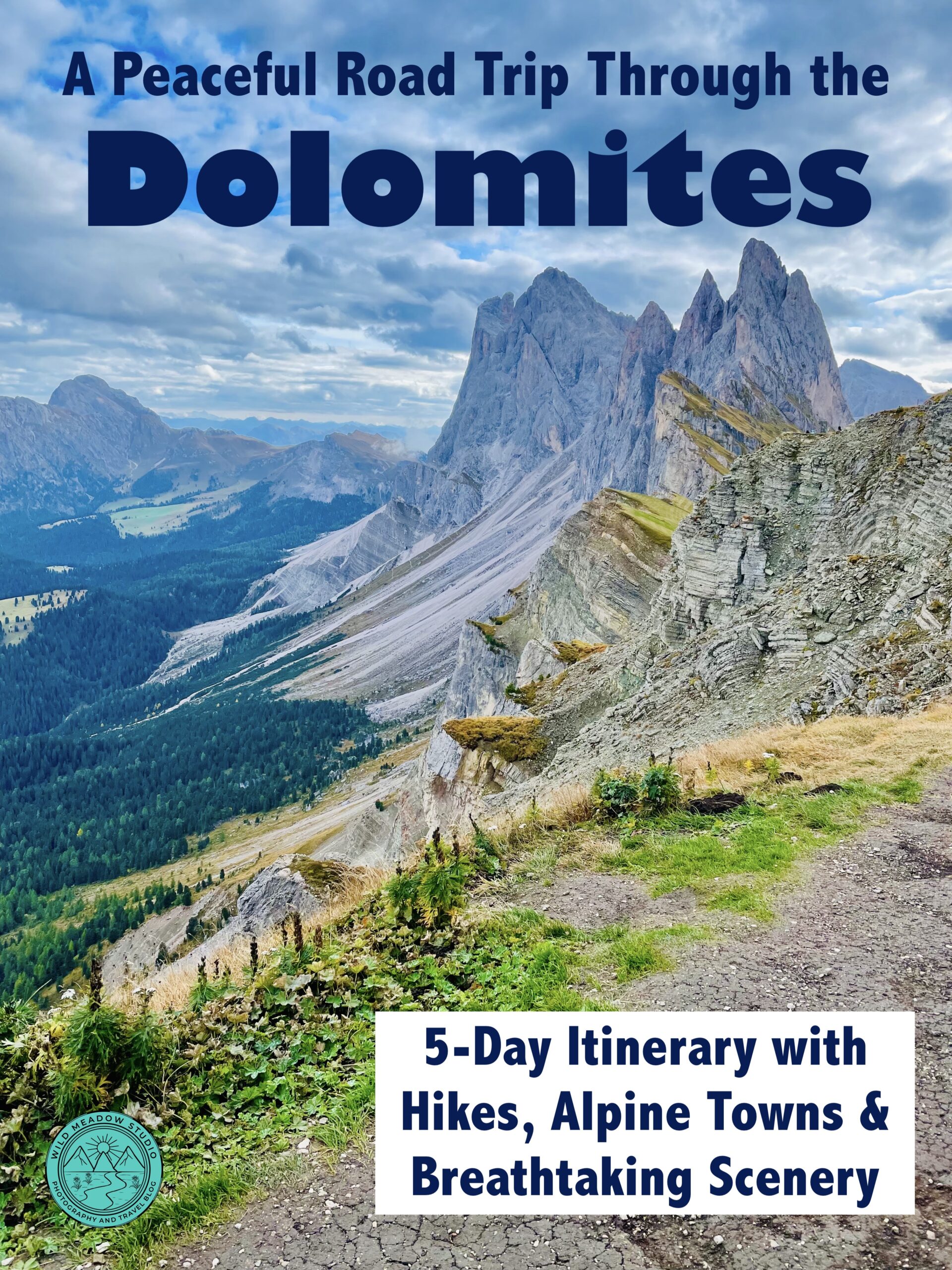
This 5-day itinerary balances early mornings with lighter afternoons and combines the Dolomites’ most famous landscapes with authentic mountain towns.
A rental car is essential for this itinerary. Looking for a car rental? We use & recommend Expedia, for car rentals, activities, flights, accommodations and more, it’s a one stop shop. We also use Get Your Guide, and Viator for activates and tours.
Check out our series on the Dolomites: “5 Great Hikes in the Dolomites with Incredible views, (easy to moderate)”, “5 Incredible Mountain Towns to Discover in the Italian Dolomites, (including 1 hidden gem nearby)”, “A Peaceful Road Trip Through the Dolomites: 5-day Itinerary with Hikes, Alpine Towns, & Breathtaking Scenery”. ” Tips & Recommendations, Your Travel Guide to the Italian Dolomites”.
Disclosure: This post may contain affiliate links, meaning that we would get a small commission if you decided to make a purchase through one of them, at no extra cost to you and you would be supporting our small Canadian business. This would allow us to continue creating informative travel content. All the businesses we are recommending are ones we use in our travels and feel comfortable doing so!
Table of Contents:
- Day 1: Seceda Ridge Loop (Morning) & The Alpine Town of Ortisei (Afternoon)
- Day 2: Santa Maddalena (Morning) & Monte Pana Hike with Waterfall (Afternoon)
- Day 3: Lago di Braies Hike (Morning) & Kronplatz Summit Loop (Afternoon)
- Day 4: Tre Cime Loop (Morning) & Cortina d’Ampezza (Afternoon)
- Day 5: Bassano del Grappa (Transit Day)
- Quick Tips
- Map it out
- References
- The Wrap up
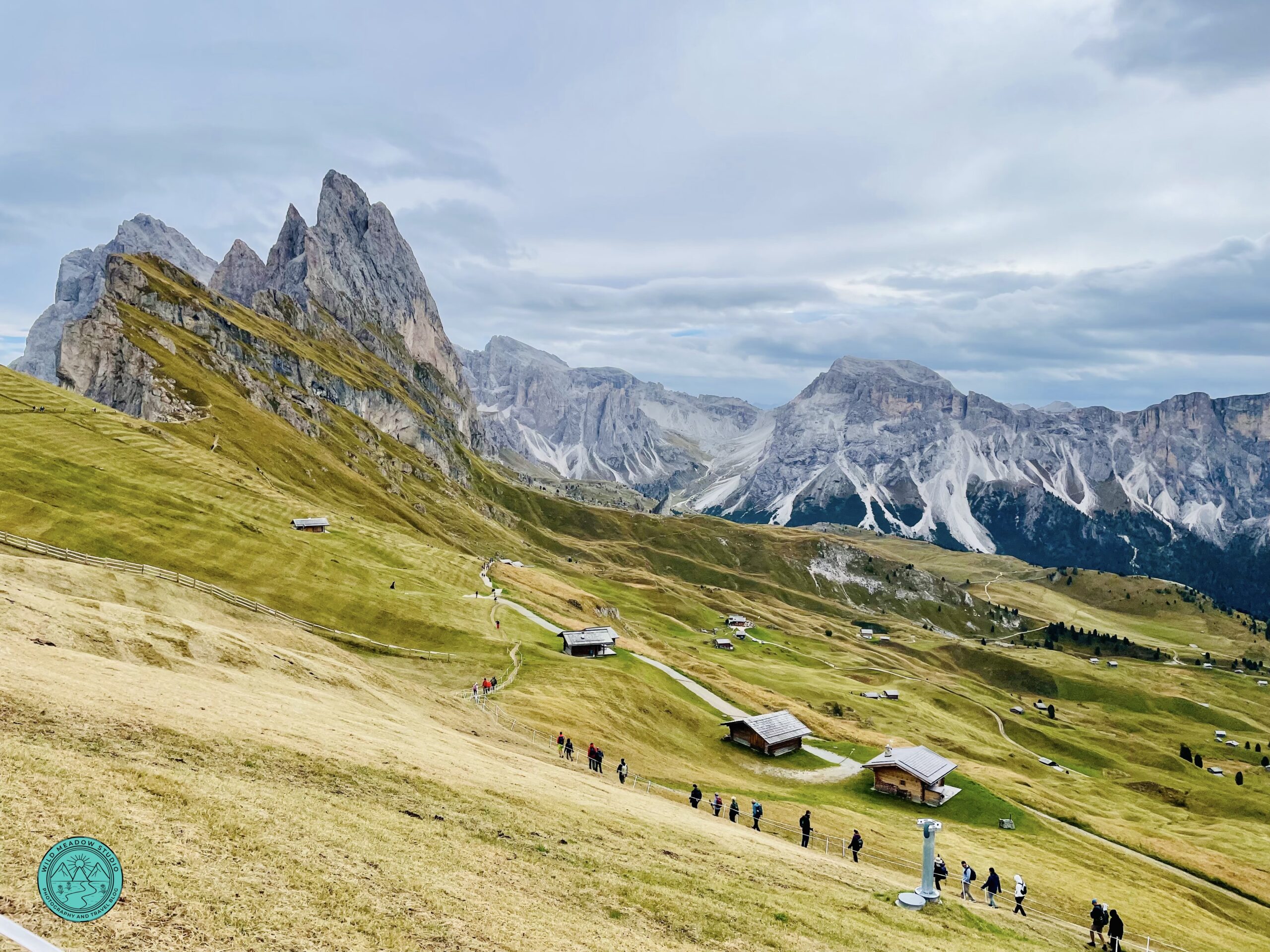
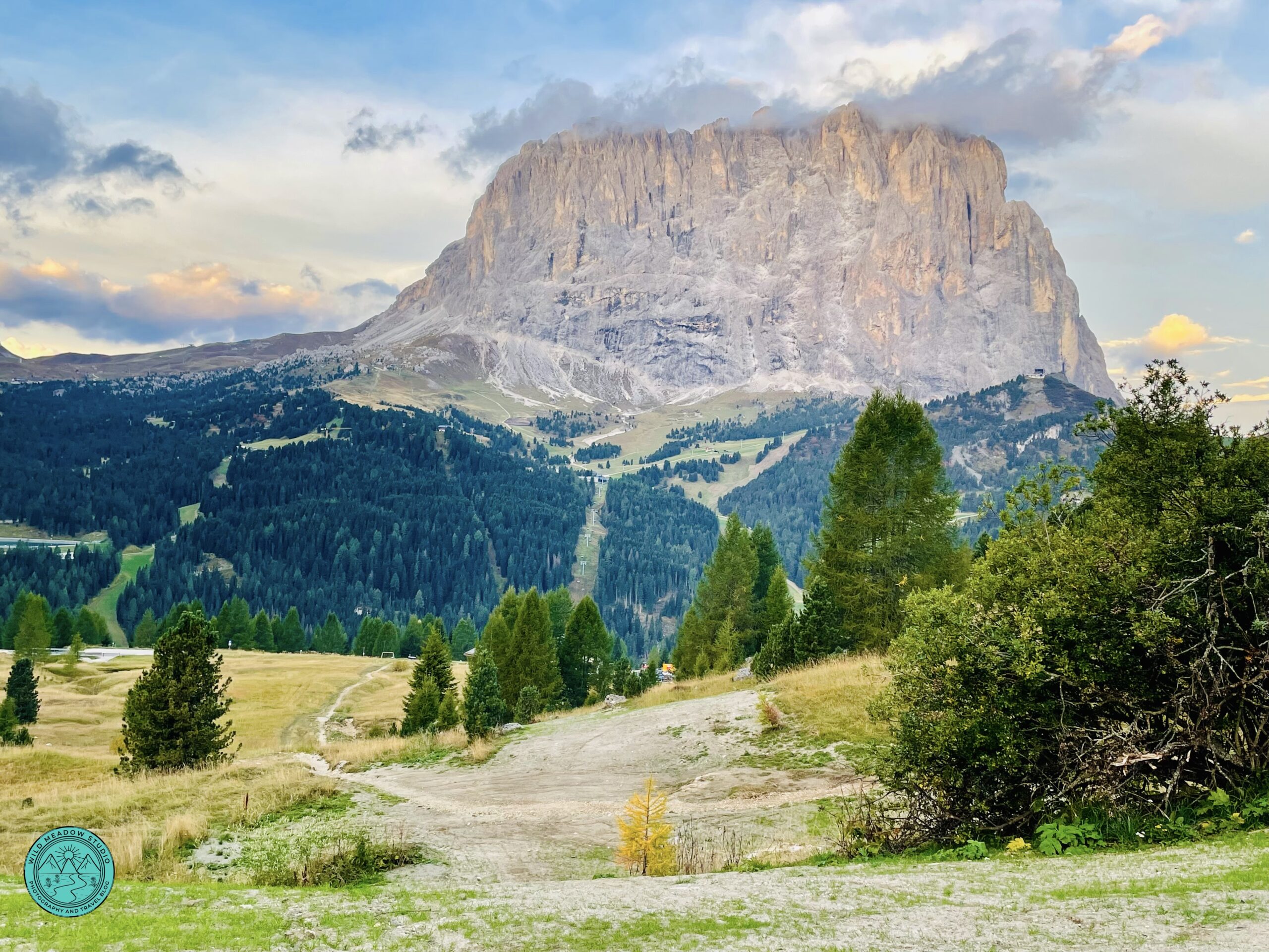
Seceda Ridgeline Hike
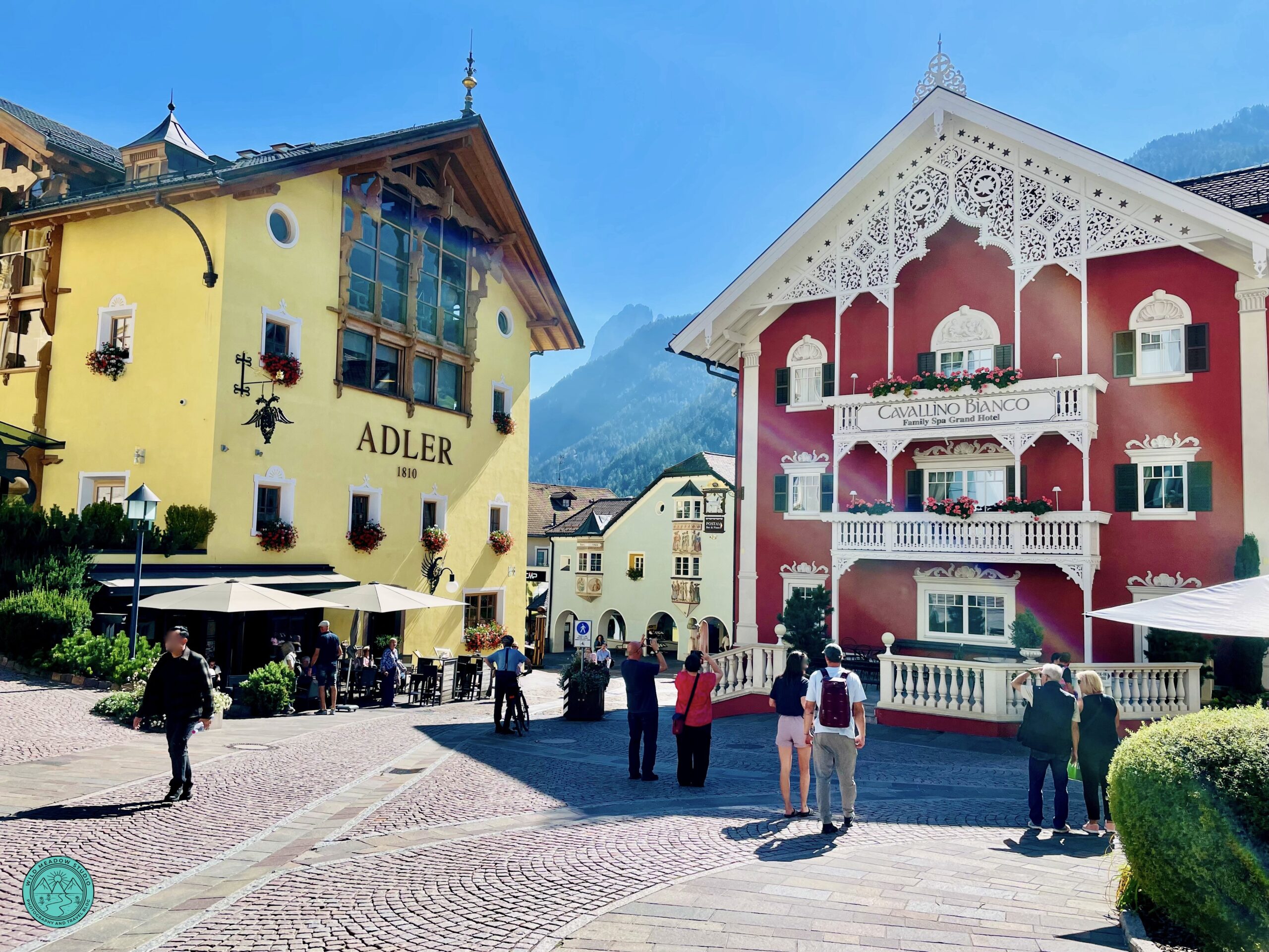
Alpine Village of Ortisei
1. Day 1: Seceda Ridge Loop (Morning) & Ortisei (Afternoon)
Driving:
Santa Cristina → Ortisei
5 km / ~10 minutes
Morning: Seceda Ridgeline Loop
Park in the Seceda cable station parking garages (paid, underground, and convenient), then head to the Ortisei–Seceda cable car station. Arriving early helps avoid lines and usually gives you the clearest views. Tickets can be purchased online before you go, which is recommended during peak season, otherwise if you arrive early during low season, you should be fine to purchase there.
The Seceda ridge loop hike is one of the Dolomites’ most iconic walks, featuring dramatic ridgelines and expansive alpine meadows. Plan 2–3 hours at the top, including time for photos and rest stops. For more information on this hike, checkout our post “5 Great Hikes in the Dolomites with Incredible Views (east to moderate)”.
Cable car tip: Seceda can be windy and cooler than the valley—bring layers even in summer. We were there mid-September, and it was t-shirt weather below and quite windy and cooler once we reached the top, so a jacket and hat came in handy.
GPS: Put Seceda Cableways AG into your GPS to get to the parking lot.
Afternoon: Ortisei
After descending, spend the afternoon exploring Ortisei’s pedestrian center. You can walk into town in about 5 mins form the cable car station parking lot if you wanted to leave your car there or you could find a spot in town, most lots are paid, so it likely doesn’t matter which you do, and some lots in town are meters, so less convenient, also, you have to watch for the ZTL signs, these indicate no tourist zones, locals only. Once you reach the town. Enjoy lunch in one of their many great restaurants, browse traditional woodcarving shops, soak in the colorful alpine architecture, and finish off with a gelato!
Return to Santa Cristina for dinner. (Checkout our Tips and Recommendations Post for Restaurant suggestions).
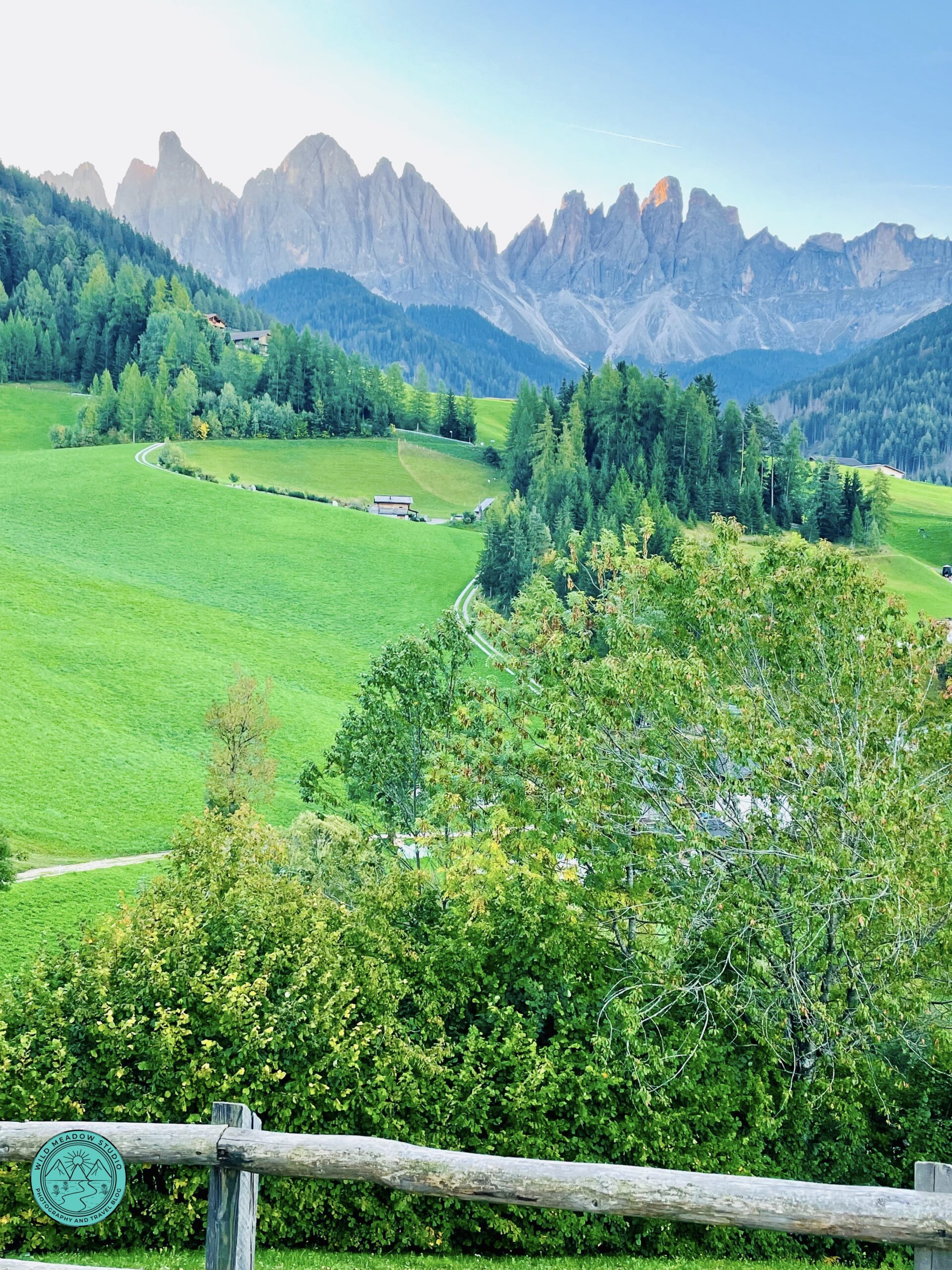
Santa Maddalena Views
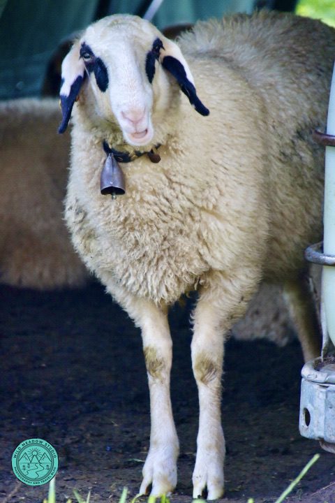
Cute Sheep in Santa Maddalena
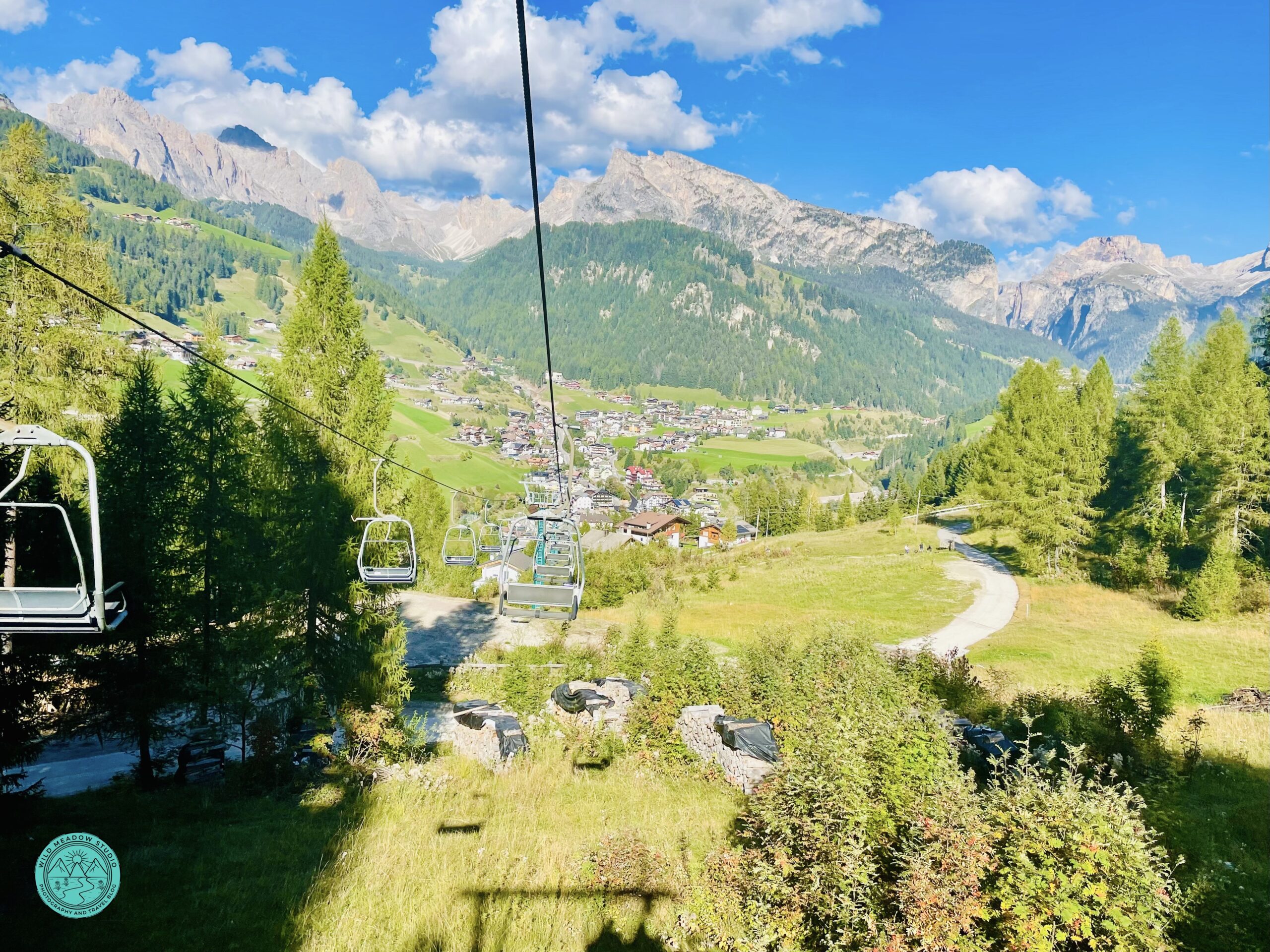
Views from Monte Pana Chair Lift
2. Day 2: Quiet Town of Santa Maddalena (Morning) & Monte Pana Hike with Waterfall (Afternoon)
Driving:
Santa Cristina → Santa Maddalena: 36 km / ~ 45 – 50 minutes
Santa Maddalena → Monte Pana Hike (back in Santa Cristina): 36 km / ~ 45 – 50 minutes
Morning: Santa Maddalena (Val di Funes)
Park in the town, (see GPS info below) and walk up to the Church of St. Magdalena. Don’t drive up to the church as that road is only for locals. Spend 1.5–2 hours enjoying the village, walking a short section of the Panorama Trail, and photographing the Odle/Geisler peaks rising behind the valley. This is truly a “pinch me moment”, the views are stunning.
Photo spots: Look for signs that say Panorama Trail (Panoramaweg) follow up the hill and take photos of the Santa Maddalena Church with the stunning mountain backdrop, and the valley along the way.
GPS: If you put Schlosskeller Restaurant at Via Bergerweg 19 into your GPS it will take you very close to a good parking lot, the lot is just west of the restaurant. Then you can walk to the Church from there.
Afternoon: Monte Pana Hike with views of Sassolungo and Waterfall
Continue back to Santa Cristina and park at the Monte Pana Cable Station, or park at your accommodation and walk, depending on where you are staying. Take the chair lift up to Monte Pana, spend a little while exploring this area and enjoying the views of Sassolungo Peak, then head back towards the chair lift and look for the signs for Hike 30B, follow the trail down the mountain and by the Cascata Tervela Waterfall. For more information on this hike, checkout our post “5 Great Hikes in the Dolomites with Incredible Views (east to moderate)”.
After, explore this charming town of Santa Cristina, checkout the church (Chiesa Parrocchiale S. Cristina), enjoy and evening walk, dinner out and maybe finish off with a Gelato at Crema & Cioccolato Gelateria at Strada Dursan 113.
GPS: Put Monte Pana Cable Station into your GPS, (Strada Pana 5).
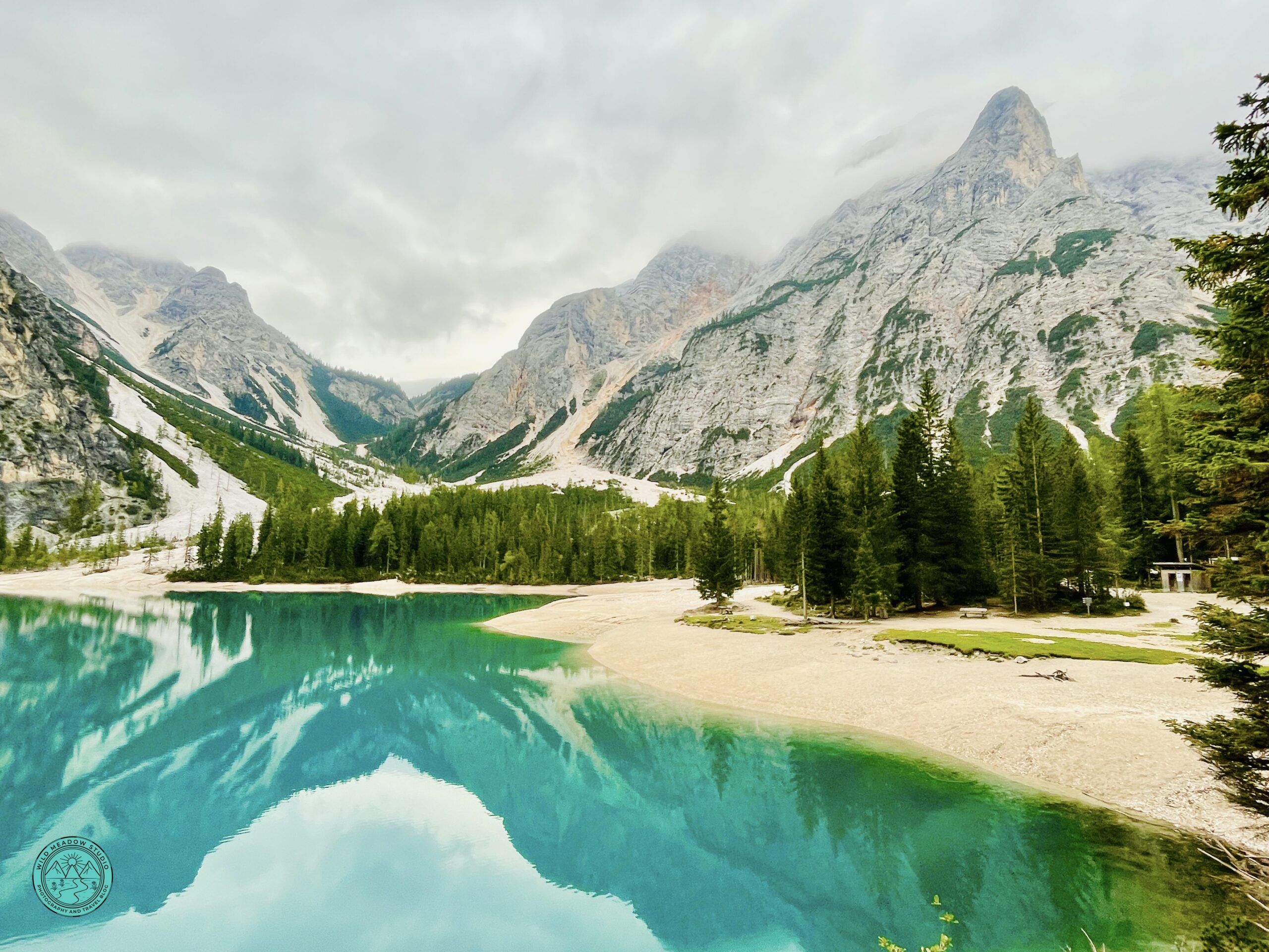
Lago di Braies Loop
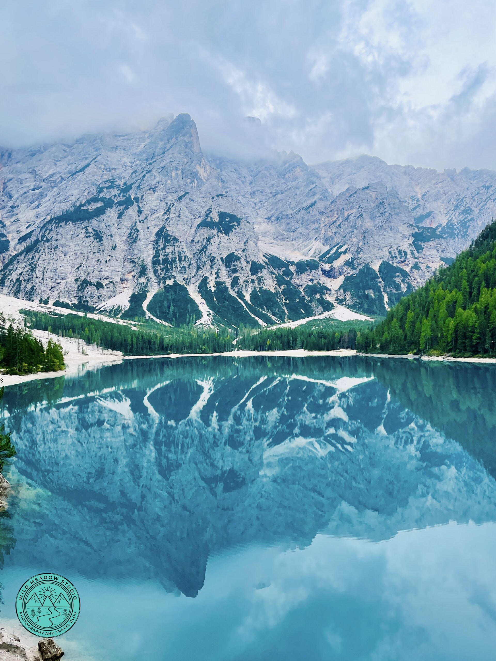
Mountain Reflections
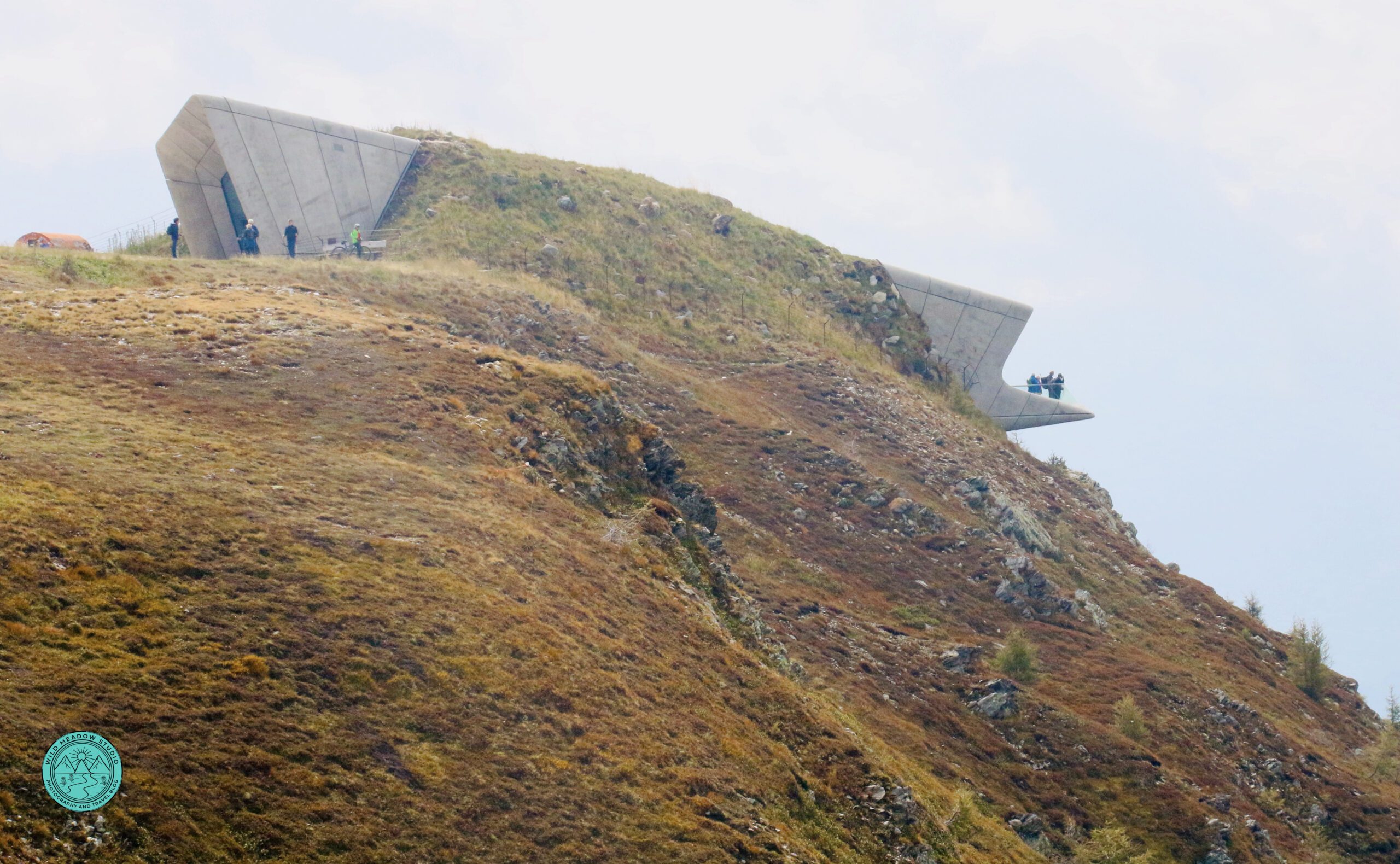
Messner Mountain Museum on top of Kronplatz
3. Day 3: Lago di Braies (Morning) & Kronplatz Summit Loop (Afternoon)
Driving:
Santa Cristina → Lago di Braies: 95 km / ~1.5 -1.75 hours
Lago di Braies → Kronplatz cable car: 30 km / ~40 minutes Kronplatz cable car – back to Santa Cristina: 71 km /1hrs 10 minutes
Morning: Lago di Braies
Arrive early to secure parking in the paid lots near the lake, especially in the peak season. Between mid-July to mid-September, the closest parking lot P4 needs to be booked online ahead of time. Walk the Braies lake loop (about 1–1.5 hours), enjoying the tranquil, quiet atmosphere and mountain reflections of the surrounding peaks before crowds build.
Photo Spot: The first views of the lake with the boathouse and the rowboats all in a line with the mountains as a backdrop, makes a great photo, start here and take photos from this side of the lake before doing the hiking loop. If you get here early there should be less crowds, so take advantage of this time.
GPS: Put Hotel Lago di Braies into your GPS and it will take you to the closet parking lot, the parking will be on your right before you get to the hotel.
Afternoon: Kronplatz
Drive to the Kronplatz cable car base station, near Brunico, called the Cabinovia Plan de Corones (hours vary for the cable car, check before you go). They have a large parking area and washrooms. Ride to the summit and walk the Kronplatz summit loop, an easy panoramic trail with 360-degree views. Plan 1.5–2 hours at the top, or possibly longer if you explore either or both recommended mountain museums. For more information on this hike and museums, checkout our post “5 Great Hikes in the Dolomites with Incredible Views (east to moderate)”.
GPS: Put Cabinovia Plan de Corones into your GPS.
Return to Santa Cristina for the evening.
Along the Tre Cime Loop
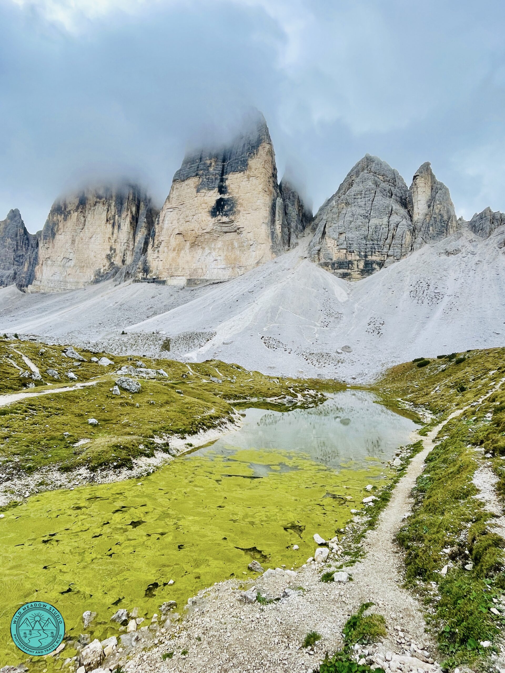
Views of Tre Cime
Views from Cortina d’Ampezzo
4. Day 4: Tre Cime Loop (Morning) & Cortina d’Ampezzo (Afternoon)
Driving:
Santa Cristina → Tre Cime toll road: 83 km / ~1.75–2 hours
Tre Cime → Cortina d’Ampezzo: 25 km / ~45 minutes Cortina d’Ampezzo – Santa Cristina: 60 km / 1.5-1.75 hours
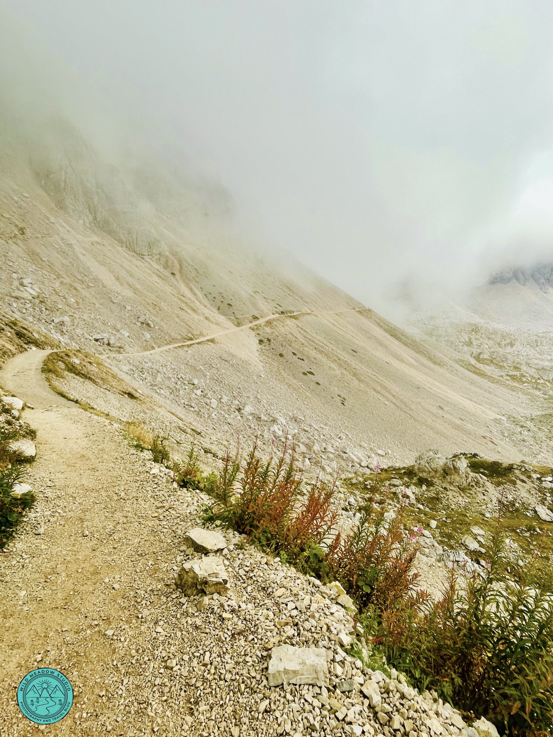
Morning: Tre Cime di Lavaredo
Depart very early (6:00 to 7:00am) as this is our longest day and hike. Head to the parking lot at the Rifugio Auronzo parking lot (paid, booking required for toll road and parking, limited spaces). Hike the Tre Cime loop, allowing 3–4 hours for the full loop. Stop at a Rifugio for lunch along the way or bring a picnic lunch, this is a truly stunning hike, more difficult than the others, but worth it. For more information on this hike, checkout our post “5 Great Hikes in the Dolomites with Incredible Views (east to moderate)”.
GPS: Put Rifugio Auronzo into your GPS.
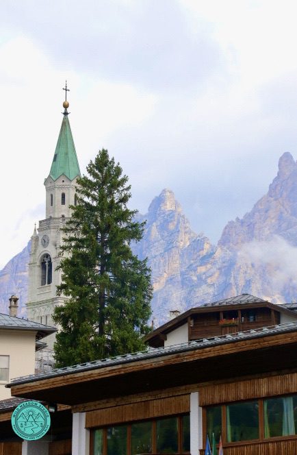
Afternoon: Cortina d’Ampezzo
Drive to Cortina d’Ampezzo and park in one of the central paid garages or street parking areas (we parked in a public lot at Corso Italia 197). Spend 2–3 hours strolling Corso Italia, enjoying coffee and a treat or aperitivo, and exploring shops with a mountain backdrop. Check out their Olympic connection, from the Olympic stadium, luge track and Olympic Rings around town. You will have about an hour and a half drive home, so you could either enjoy a dinner here, then head back to Santa Cristina or explore Cortina for a while then head back and have dinner in Santa Cristina.
GPS: Put Corso Italia 197, Cortina d’Ampezzo into your GPS, (make sure you put Cortina in as there are other cities with that address).
Return to Santa Cristina for your final night.
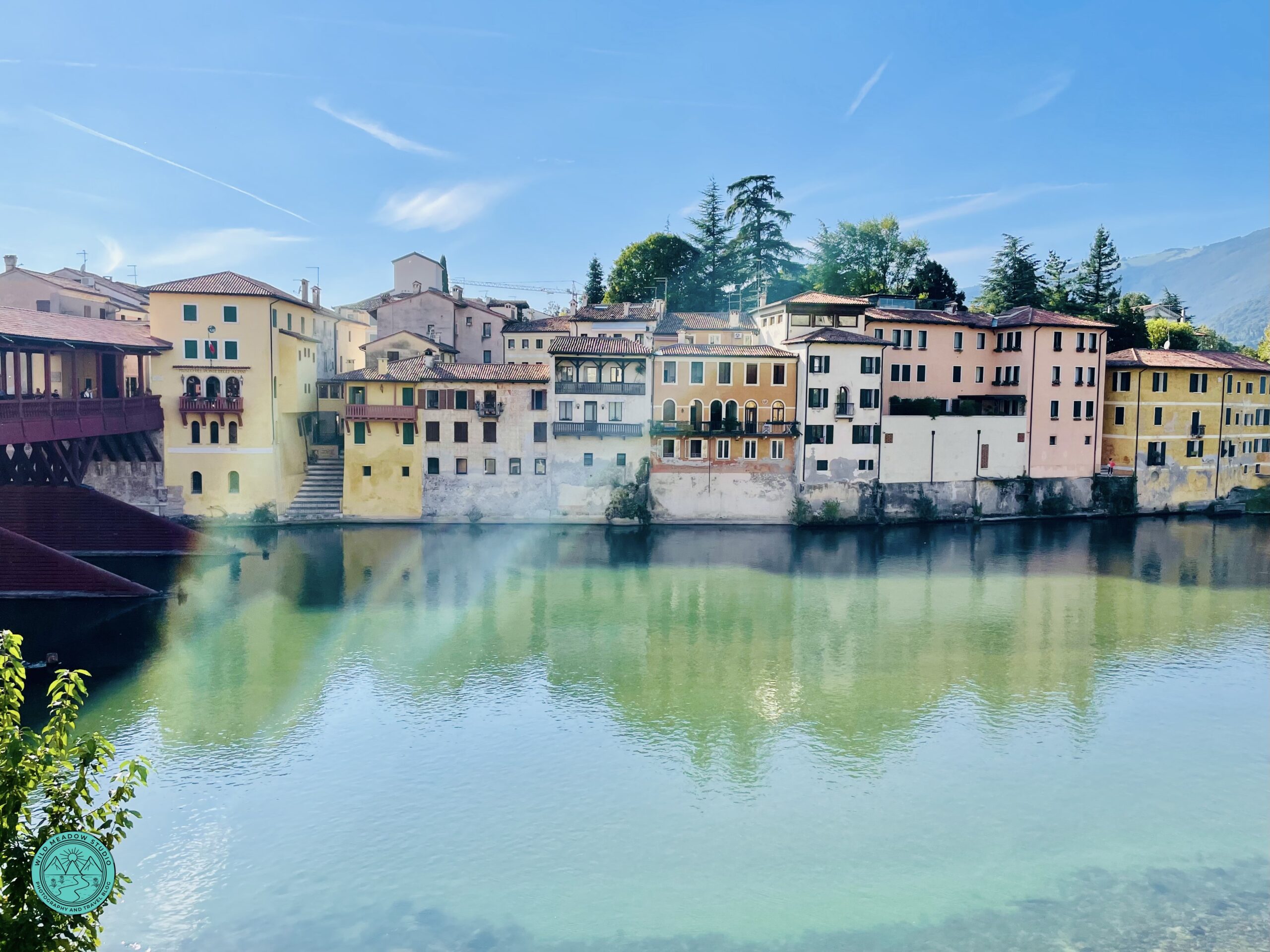
Bassano del Grappa
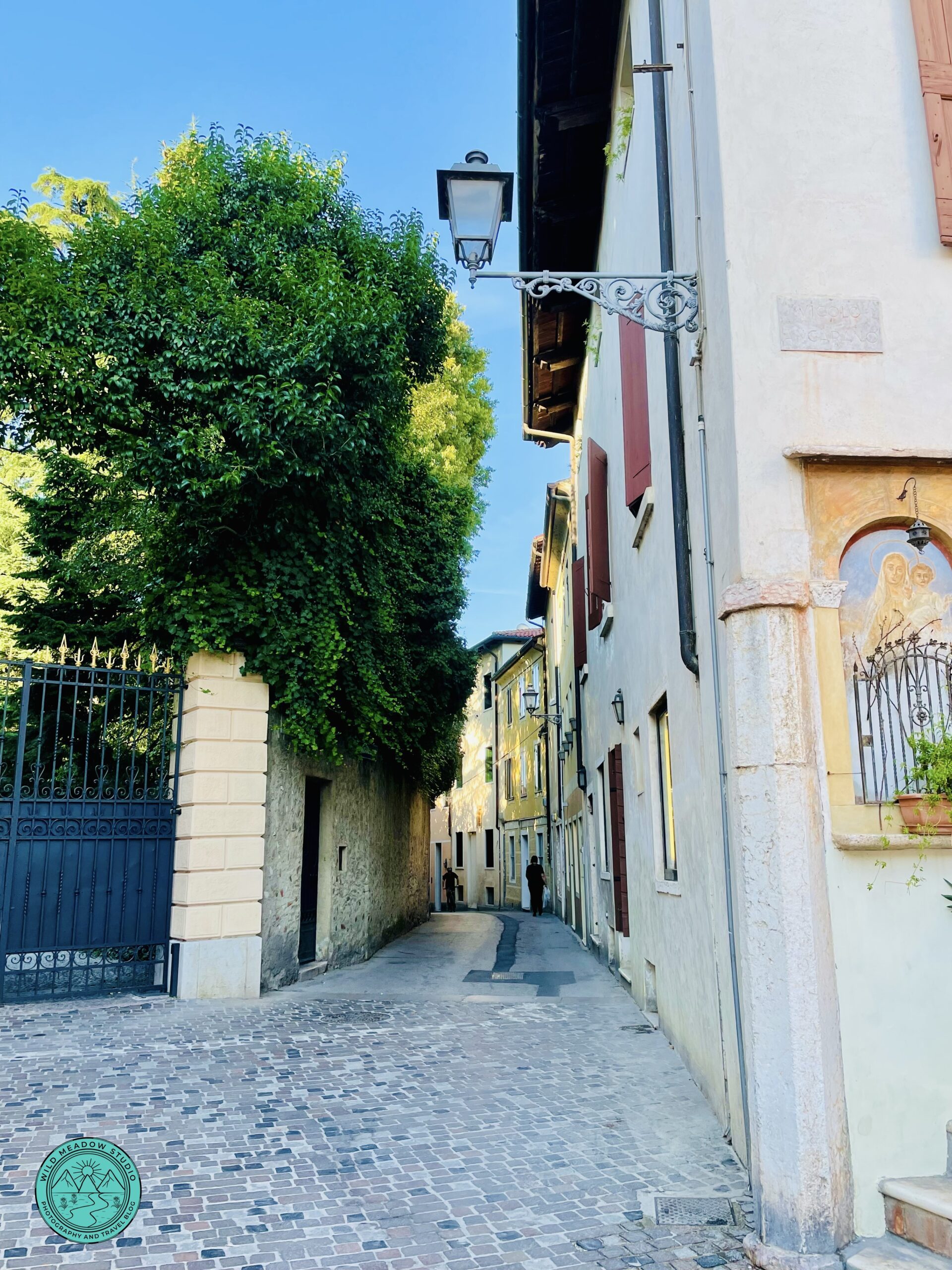
Cobblestone Streets
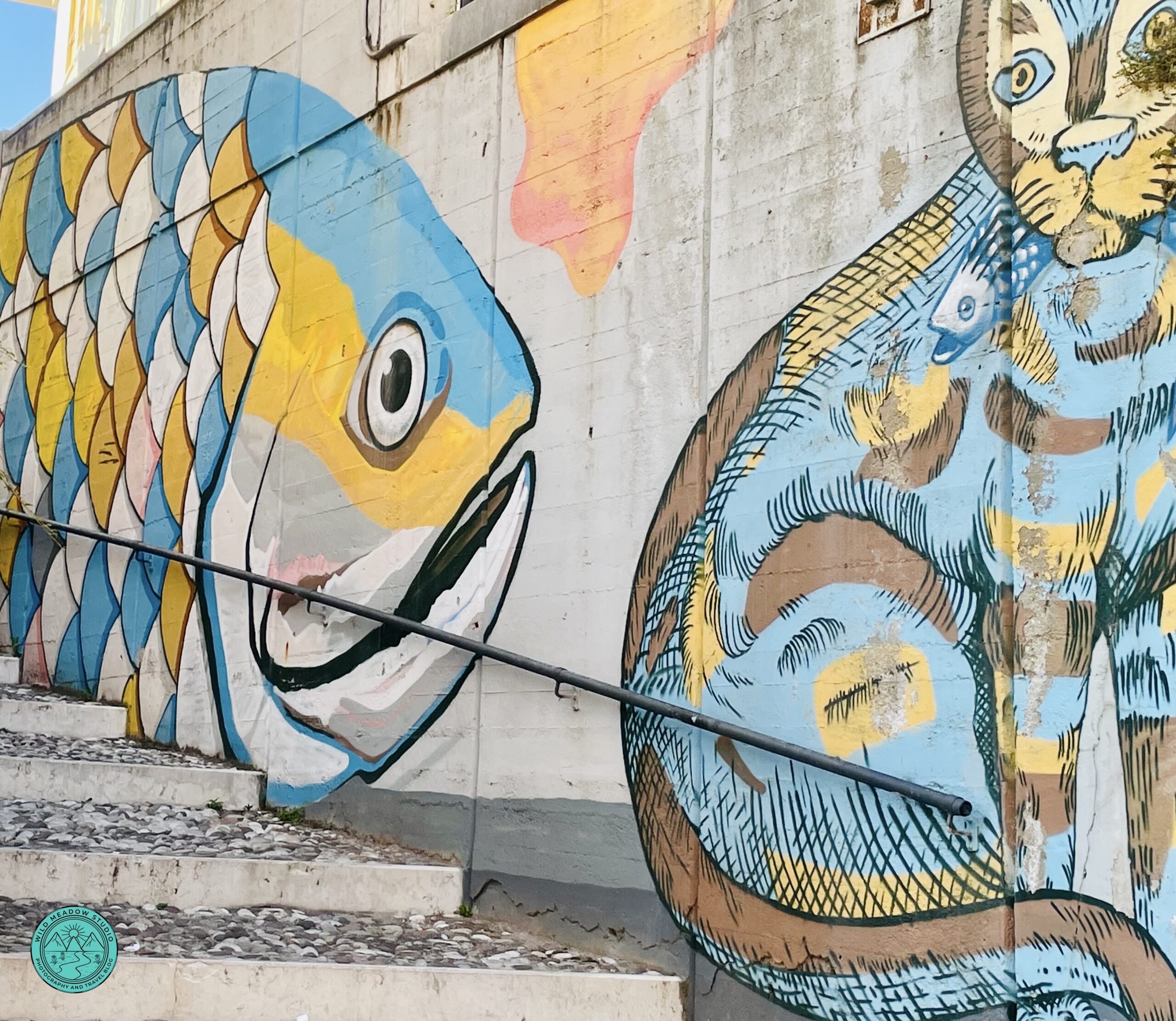
Street Art
5. Day 5: Bassano del Grappa (Transit Day)
Driving:
Santa Cristina → Bassano del Grappa: 180 km / ~2.5 hours
Bassano del Grappa → Venice: 84 km / ~55 mins–1 hour
Bassano del Grappa is best visited on the way to or from the Dolomites, rather than as a day trip.
Park in one of the large lots near the historic center (we parked here Via Prato Santa Caterina) and spend 3–4 hours exploring, walking across the Ponte degli Alpini, exploring the old town, and enjoying riverside views. It’s an ideal cultural pause between mountain and city travel. Make sure to try their name’s sake spirit Grappa. We stopped here on the way from the Venice Airport to Santa Cristina, had lunch, Grappa, gelato and simply explored and photographed this beautiful, historic, riverside town.
GPS: Put Via Prato Santa Caterina 36061, Bassano del Grappa into your GPS.
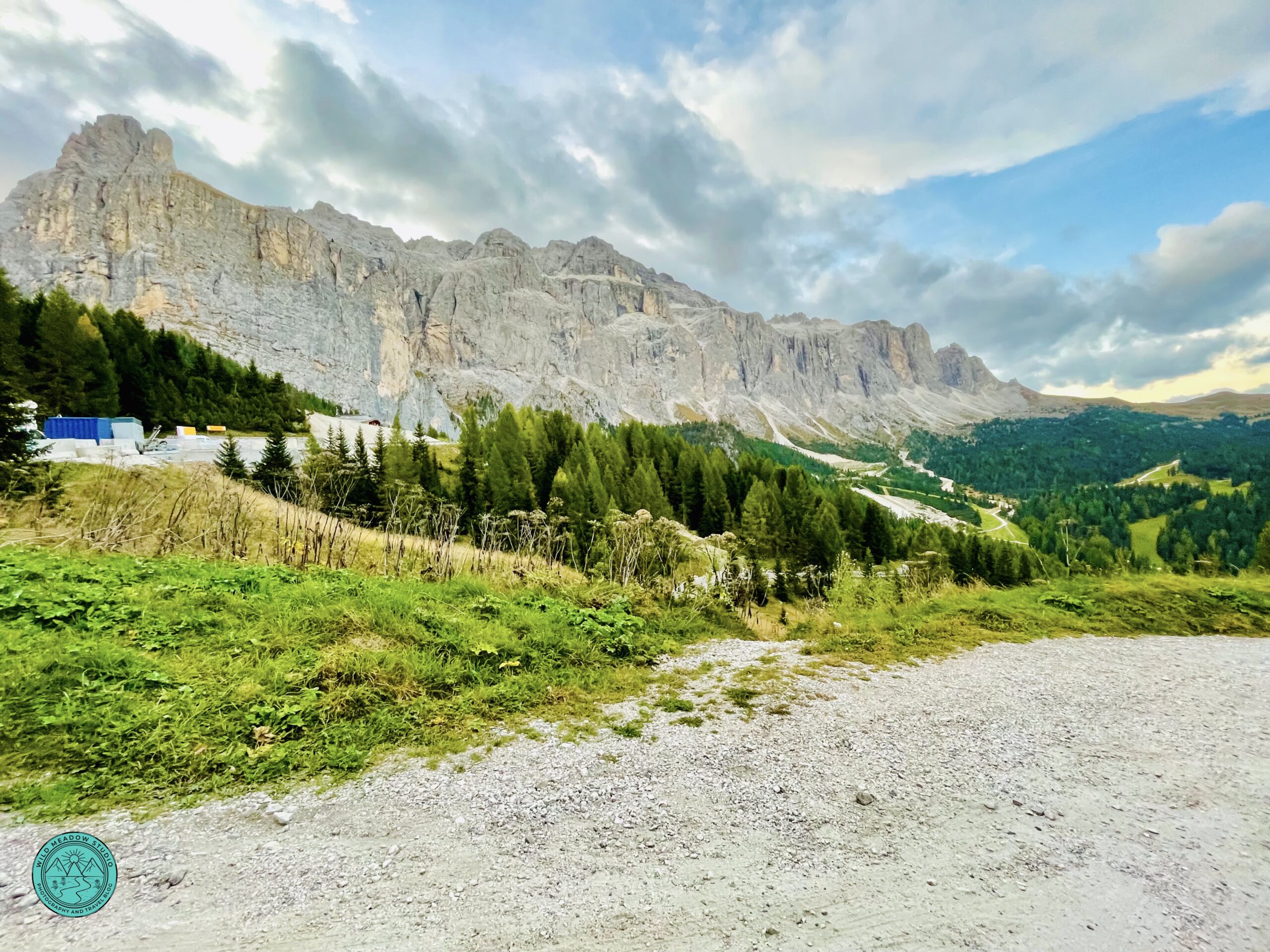
Along the road to Cortina d’ampezzo
More Road Trip Mountain Views
6. Quick Tips:
Practical Tips for Driving & Cable Cars
- Start early on Tre Cime and Braies days, as the driving distances are longer and to avoid parking issues & crowds.
- Mountain roads are slow but scenic—build in buffer time for stops.
- Carry a light jacket for cable-car summits, and early hikes, even in summer.
- Most parking areas accept cards, but some must be booked online in advance.
- Some of the parking lots and cable car stations have pay washrooms so having some cash on hand can be helpful.
- Make sure you have good supportive and comfortable shoes.
- You should have some kind of internet service, whether it’s an eSim card, or pocket WIFI, so you have access to some kind of maps on your phone, to use as a GPS.
- Or rent a GPS with your car rental.
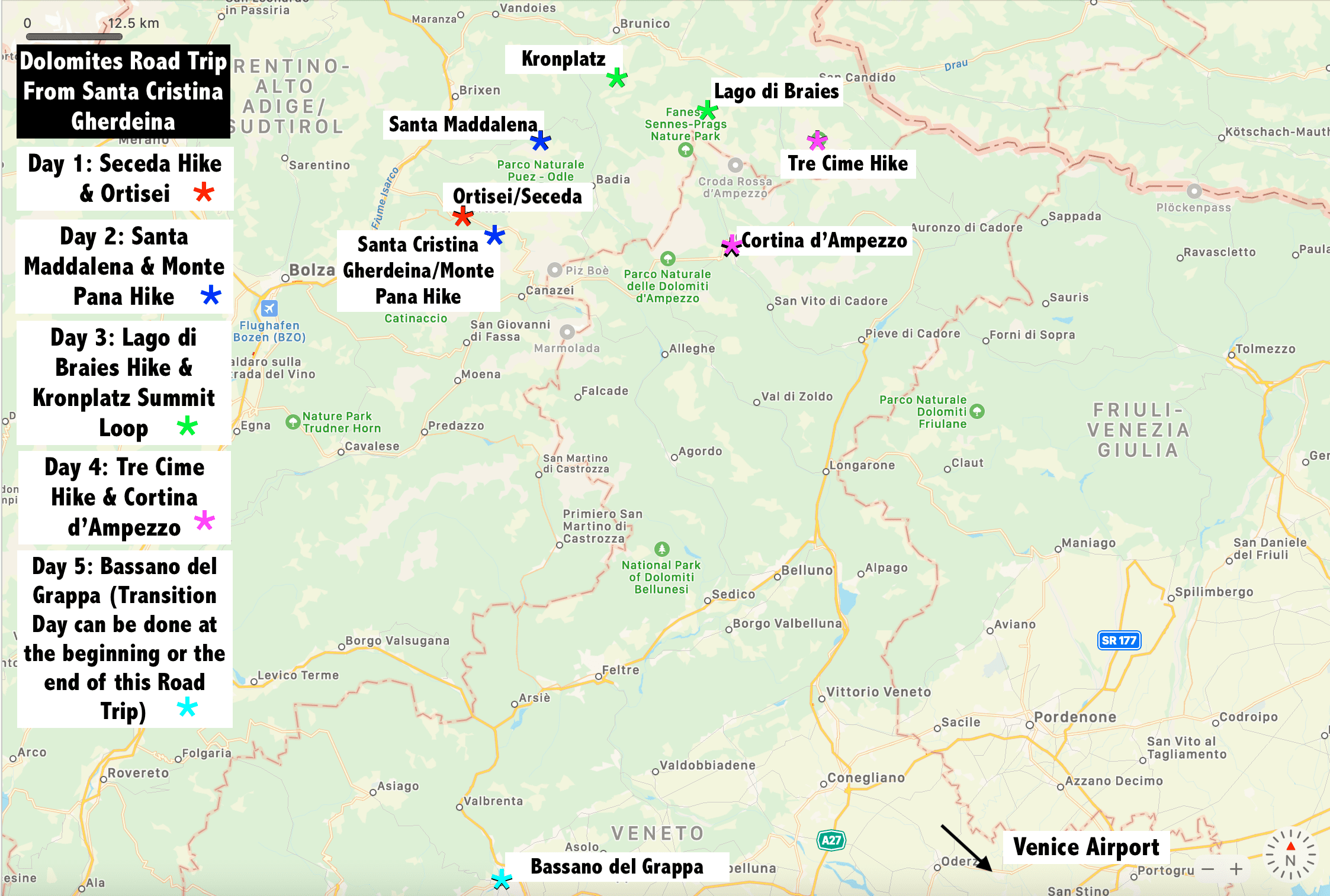
7. Map it out:
This map is just meant to give you an overview of where you’ll be going during this 5-day Road Trip Itinerary. We’ve grouped some places together that were in the same area or made sense to do in the same day, some are longer days than others, but all worked well for us, and we really enjoyed each day, hopefully you will too. For more information on these hikes, checkout our post “5 Great Hikes in the Dolomites with Incredible Views (east to moderate)”. For more information on these Towns, checkout our post “5 Incredible Mountain Towns to Discover in the Italian Dolomites, (including 1 Hidden Gem Nearby)”.
Focus on the Journey!
8. References:
All this information, research and suggestions came from our own experiences we had while visiting this stunning, mountainous region of Italy. As well, we spent countless hours reading travel books, like DK Eyewitness Travel, Italy and DK Eyewitness Travel, Back Roads, Northern & Central Italy and the Rick Steves Italy. We also read multiple Travel blogs and Italian tourism websites like, dolomiti.org.
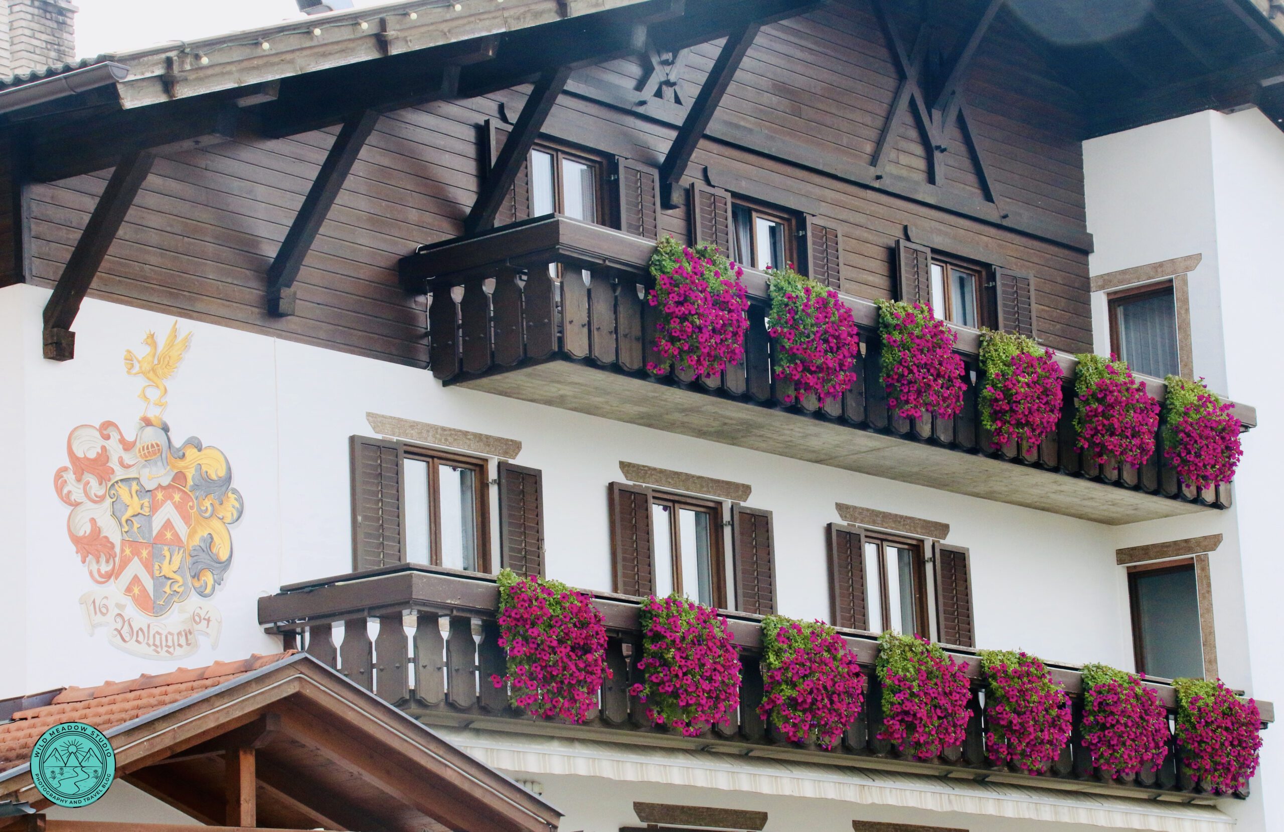
Alpine Architecture
9. The Wrap Up:
Why This Itinerary Works
- One base minimizes logistics, stress and packing and unpacking.
- Iconic hikes are paired with relaxed town visits.
- Driving distances are grouped efficiently.
- Each day balances scenery, activity, and downtime
**Join our Mailing List and be the first to receive exclusive offers, notification of our newest Travel Blogs and our monthly Inspirational Newsletter! Join at the top of the page or through one of the pop ups on our website! **
Thank you,
Beth de Verteuil
From, Wild Meadow Studio
Where we help you, Focus on the Journey,